Digimaps for schools
During a Georgraphy session at univerisity we were introduced to Digimaps for schools. This is an online mapping service. It provides access to present and historical Ordanance Survey maps, as well as a wide selection of other map resources. These maps have been digitalised and can be edited, annotated and printed. The search option allows you to find maps uisng a postcode, grid reference or place name. Map keys are also displayed to help indentify map symbols.
Digimaps is a paid subscription service, and kindly the university has given us access for a year.
It is a great resource for children to use independently or for group work. It is also a good interactive whiteboard resource. It is a lot simpler and easier than getting out lots of maps and putting it on the IWB means that the whole class can see. It introduces children to maps in a fun and interactive way. However, I think that children should also explore and learn to use physical maps as well.
There is a very helpful user guide available which helps explain what all the tools and buttons do.
Digimaps also produced a great resource with ideas for using digimaps within Geography through games and stories.
I especially like the Jigsaw idea, where a map is printed of, laminated and cut up into pieces. Children then work in groups to piece the map together. It involves collaboration and discussion. To make the task more challenging, a piece could be removed and replaced with a blank piece. Children then have to draw what they think might be on it, based on the rest of the jigsaw.
I especially like the Jigsaw idea, where a map is printed of, laminated and cut up into pieces. Children then work in groups to piece the map together. It involves collaboration and discussion. To make the task more challenging, a piece could be removed and replaced with a blank piece. Children then have to draw what they think might be on it, based on the rest of the jigsaw.
The tool I like most is the slider which control the historic layer mapping. The 1890s blue slider when slid to the left decreases a historic maps transparency. This means you can see the historic map underneath the modern one. There are 3 different transparencies layers. A historic and modern map can be combined so that changes can be compared. Perhaps children could explore the area around their school or where they live. They could look at historical maps from their area and compare then and now.
John ryland's UOM image collection
Another useful map resource we were shown was the John Ryland's University Library Images Collection.
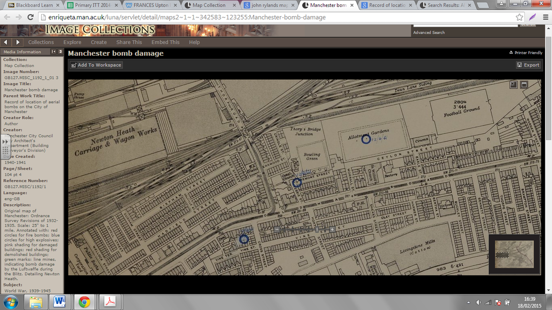
http://enriqueta.man.ac.uk/luna/servlet/detail/maps2~1~1~342583~123255:Manchester-bomb-damage
This website provides access to maps showing where bombs landed in WW2. This is useful because it shows how a maps can tell a story. Children can actually see where things happened and it brings history alive.
That evening, I went home and spoke to my father, I knew my grandfather was a volunteer fire engine driver during the war. My father then told me he remembers his father telling him the story of when a bomb landed in his back garden. I have been searching through the maps and hope to find the one that matches this description soon!
These historical maps create a cross-curricular link. It also makes learning relevant by placing it either in the context of where children live or because it is connected to the teacher in some way. The maps help tell a story and this can be very engaging and exciting.